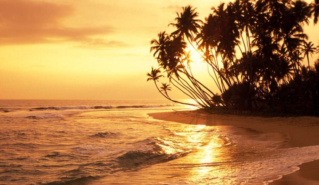
If Silavathurai is defined by its refusal to announce itself, the Doric Bungalow is the exception that proves the rule, a structure that once screamed for attention and is now being silenced by the sea. Located just a short drive south of the main town, past the scrubby palmyrah groves, this is perhaps the most poignant ruin in all of Sri Lanka.
It stands on a high cliff of red earth, a solitary skeleton of red brick and crumbling mortar. Built in the early 19th century by the first British Governor of Ceylon, Frederick North, it was designed to be a majestic official residence from which he could oversee the lucrative pearl fisheries. It was a building of Greek columns and European arrogance, constructed in a place where the salt air eats iron and stone for breakfast.
To visit the Doric is to witness a slow-motion collision between imperial vanity and geological reality. There are no fences, no ticket counters, and often, no other souls. You can walk right up to the edge of the cliff, which recedes a little more every monsoon and look up at the gaping arches.
The “thing to do” here is not just to snap a photo, but to trace the forensic evidence of the building’s death. You can see where the grand staircase has sheared off and fallen into the ocean below, now just a pile of bricks buffeted by the waves. You can see the layers of the walls, revealing the oyster shells used in the mortar mixture, the very resource the building was meant to exploit, eventually becoming part of its decay.
The best time to visit is late afternoon. The setting sun hits the red bricks, turning the ruin into a glowing ember against the darkening blue of the Indian Ocean. It is a place to contemplate the temporary nature of power. Governor North planned a palace; the wind has turned it into a sculpture. Standing inside the roofless shell, with the wind howling through the window frames, is a sensory experience that history books cannot replicate.
Arippu Fort: The Sentinel of the Scrubland
Further along the coast, near the mouth of the Aruvi Aru river, lies the Arippu Fort. While the Doric is a romantic ruin, Arippu is a stubborn survivor. Originally a Portuguese outpost, later fortified by the Dutch and then the British, it is a squat, square structure that feels hunkered down against the elements.
Unlike the open, airy disintegration of the Doric, Arippu Fort feels hermetic. It sits amidst a landscape that feels harsh and unyielding—thorny scrub, dry earth, and wandering goats. The fort served to protect the pearl banks, but also acted as a colonial hostel of sorts.
Walking around Arippu, you notice the isolation. This was a lonely posting for any soldier stationed here three hundred years ago. Today, it remains lonely. The walls are thick, weathering into undefined lumps of masonry. Entering the structure (carefully, as stability is never guaranteed in unmaintained ruins) feels like stepping into a kiln. The heat is trapped in the stone.
This site offers a different texture to the Silavathurai experience. It’s less about the beauty of the coast and more about the grit of survival. It connects you to the strategic importance this quiet coastline once held. For centuries, this wasn’t a “silent coast”—it was the economic engine of the island, guarded by cannons and men who sweated in wool uniforms under the tropical sun.
The Ghost of the Pearl Fishery
To understand Silavathurai, you must engage with what is no longer there: the Great Pearl Fishery. For two thousand years, this stretch of ocean, known as the Gulf of Mannar, was the world’s premier source of natural pearls. Pliny the Elder wrote of them; merchants from Rome, Arabia, and China sailed here for them.
There is no museum in Silavathurai dedicated to this. Instead, the history is written in the landscape, if you know how to read it. As you walk the beaches south of the town, specifically towards the area historically known as Condatchey (Kondachchi), you are walking on the site of ephemeral cities. During a pearl fishery season in the 1800s, this empty, silent scrubland would transform overnight into a bustling metropolis of 50,000 people divers, merchants, financiers, conjurers, and thieves. They built huts of palm fronds, haggled in a dozen languages, and then, when the season ended, burned the huts and vanished, leaving the coast to the jackals and the wind.
The “activity” here is an exercise in imagination. Stand on the bay at Kondachchi. Close your eyes. Replace the sound of the wind with the imagined cacophony of a boomtown. Picture the fleet of hundreds of boats launching at midnight to reach the pearl banks by dawn. This mental superimposition changes how you see the emptiness. The silence of Silavathurai isn’t a void; it’s the quiet that returns after the party is over. It is a post-industrial landscape, but the industry was organic, and the factories were wooden boats.
The Red Earth of Kudiramalai
For those willing to venture further south, the landscape shifts dramatically at Kudiramalai Point (Horse Mountain). The geography here undergoes a violent change: the pale, beige sands of Silavathurai are suddenly replaced by copper-red earth and black rocks.
This is a place of legends. It is said to be the landing point of Prince Vijaya, the legendary first king of the Sinhalese, who supposedly kissed the ground upon arrival, staining his hands red (hence the name Thambapanni, or copper-colored palms). It is also associated with Queen Alli Arasani, a legendary warrior queen who is said to have ruled this coast.
The drive here is difficult—often requiring a 4WD vehicle as the roads deteriorate into sandy tracks but the visual payoff is immense. The contrast of the blood-red cliffs against the turquoise ocean is surreal, looking more like Mars than Sri Lanka.
At the top of the point, you will find traces of ancient Shiva worship stone pillars and vague foundations. The wind here is ferocious. It whips around the headland, making it clear why this was a landmark for ancient mariners. It is a place to observe the raw power of geology. The red soil is rich in iron, a stark anomaly in the limestone-dominant region.
Visiting Kudiramalai is a full-day commitment from Silavathurai, often combined with the edge of Wilpattu, but it offers a profound sense of “edge of the world” isolation. You are far from the tourist trail here. You are in the realm of myth.
The Back Door to Wilpattu: The Modaragam Aru
Silavathurai sits on the doorstep of Sri Lanka’s largest national park, Wilpattu, but it sits at the “back door.” While hundreds of jeeps queue at the main southern entrance, the northern boundary, marked by the Modaragam Aru river, remains quiet, wild, and largely ignored by commercial tourism.
From Silavathurai, you can drive south to the river mouth. You don’t need to enter the park to feel its presence. The landscape transitions from coastal scrub to dense, dry-zone jungle. The birdlife changes—peacocks become common, perched like gaudy ornaments on dead trees; hornbills swoop across the road.
This area offers a chance for riverine exploration. The river mouth, where the fresh water of the jungle meets the salt water of the Palk Strait, is a biodiversity hotspot. It is a place to sit quietly with binoculars. You might spot crocodiles sunning themselves on the banks, indistinguishable from logs until they blink. You might see sea eagles hunting.
This is nature without the safari price tag and without the safari chaotic energy. It is a place to appreciate the transition zones where the ocean ends and the deep forest begins. For the respectful traveler, the edges of the park offer a sense of intimacy with nature that the interior tracks, crowded with engines, often lack.
The Baobab Sentinels of Mannar Island
While Silavathurai is your base, a day trip north to Mannar Island is essential to understand the broader context of this coast. The transition from the mainland to the island, across the long, narrow causeway, feels like entering a different country. The light seems harsher, the water on either side blindingly bright.
The primary reason to cross, beyond the famous fort, is to see the Baobab trees. These are botanical aliens. Native to Africa, they were brought here centuries ago by Arab traders who fed their camels with the leaves.
The Baobabs in Mannar (particularly the pallimunai Baobab) are monstrous, bulging, grotesque, and magnificent. They look like trees drawn by a child—trunks too thick for their branches, gray and wrinkled like elephant skin. Some are over 700 years old. They are living artifacts of the ancient maritime silk route.
Touching the rough bark of a Baobab connects you to a time when this quiet coast was a hub of globalization. These trees have seen Portuguese muskets, Dutch canons, British rifles, and the recent civil war. They have outlasted them all. They stand in stark contrast to the slender, swaying coconut palms and palmyrahs that define the rest of the island. They are stubborn, awkward, and enduring—much like the region itself.
The Vankalai Sanctuary: A Theatre of Wings
On the mainland side of the causeway, not far from Silavathurai, lies the Vankalai Bird Sanctuary. This is not a park with gates and guides; it is a vast expanse of mudflats, salt marshes, and lagoons.
For the birdwatcher, this is holy ground. During the migratory season (roughly October to April), the water turns pink with thousands of Greater Flamingos. Watching a flock of flamingos take flight is one of nature’s most spectacular distinct visuals a ripple of crimson and black against the pale blue sky.
But even without the flamingos, Vankalai is hypnotic. It is a landscape of horizontals. The water is shallow, mirroring the sky perfectly. Spot-billed ducks, Northern Pintails, and various waders pick their way through the silt.
The best way to experience Vankalai is to simply pull over your vehicle safely along the causeway or the perimeter roads and wait. There is no hiking here—it is a wetland. You observe from the edges. The silence of Silavathurai extends here, broken only by the piping calls of shorebirds and the wet slap of wind on water. It is a place that demands patience, rewarding the stillness of the observer with the movement of the flock.
The Living Culture: Musali and the Return
Silavathurai is part of the Musali division, an area that saw the total displacement of its population during the war. The people predominantly Muslims and Tamils were forced to leave in 1990 and only began returning years after the war ended.
As you explore the backroads around Silavathurai, you are witnessing a society in the process of re-weaving itself. You will see new mosques painted in vibrant greens and whites, standing out against the dusty brown earth. These aren’t just places of worship; they are flags of return, markers of a community reclaiming its home.
Things to do in this context involve human connection, but of a subtle kind.
Visit the Local Bakeries: In the early evening, small bakeries in the village centers come alive. Try the kimbula banis (crocodile bun) or local fish patties. Buying from these shops is a direct way to support the local economy.
Observe the Palmyra Economy: You will see fences made of palmyrah fronds, roofs thatched with them, and fruits drying in the sun. The palmyrah tree is the lifeline of the north. If you see locals processing the fruit or weaving the leaves, stop and watch (from a respectful distance, or closer if invited). It is a craft honed by necessity and tradition.
Culinary Simplicity: Tasting the Salt
The food in Silavathurai is not “restaurant food.” It is home cooking, even when served in a roadside eatery.
Mannar Crab: The region is famous for its blue swimmer crabs. Unlike the export-quality crabs that vanish to Colombo or Singapore, the crabs here are smaller but sweeter, often cooked in a fiery red curry loaded with drumstick leaves (murunga) and spices that hit the back of your throat.
Dried Fish (Karawala): You will smell Silavathurai before you see it. The drying of fish is the town’s heartbeat. You can visit the drying yards (wadiyas) on the beach. While the smell is pungent, the process is fascinating. Rows of fish, salted and sun-baked, preserving the ocean’s protein for the months ahead. Buying a packet of high-quality dried fish or sprats to take home is the most authentic souvenir you can buy.
Kool: If you are lucky and make a local friend, ask about Kool. It is a seafood broth thickened with palmyrah root flour (odiyal), containing whatever the boats brought in—crab, cuttlefish, prawns, crayfish. It is a communal dish, usually made for large gatherings. It tastes like the ocean distilled into a bowl.
Nightfall: The Astronomy of Silence
Finally, there is one thing to do in Silavathurai that requires no movement at all. Because the town is small and the surrounding areas are largely undeveloped, the light pollution is minimal. On a moonless night, the sky over the Silavathurai coast is a crushing weight of stars.
Walk out to the beach after dinner. Bring a torch only to watch your step, then turn it off. Let your eyes adjust. The Milky Way is often visible as a bruised purple/white band across the sky. You can see satellites moving like slow, steady stars.
In the city, night is a time of artificial lights. Here, night is absolute. The sound of the waves seems louder in the dark. Standing there, under a galaxy that looks exactly as it did when the pearl divers slept on these shores two thousand years ago, you realize the true value of Silavathurai.
It is not just a place to see things. It is a place to regain a sense of scale. The ruins tell you that empires fall. The sea tells you that nature persists. The stars tell you that you are small. And in a world that constantly tells you that you are the center of the universe, that reminder is perhaps the most refreshing vacation of all.
Final Practical Notes for the Extended Journey
Fuel Management: If you plan to drive to Kudiramalai or explore the deep backroads of Musali, ensure your tank is full. Gas stations are sparse once you leave the Mannar/Silavathurai main road.
Water and Heat: The heat in this region is different—it is dry, searing, and deceptive. The wind cools your sweat instantly, so you don’t realize how dehydrated you are. Carry more water than you think you need.
The Checkpoints: You may still encounter navy or police checkpoints, especially near the Vankalai bridge or towards the park. They are generally routine. A smile, a lowered window, and a clear answer about your destination are all that is usually required.
The Season of Flies: Be aware that during certain fruit seasons (usually mid-year), the fly population in the agricultural areas can be intense. It’s a natural part of the ecosystem, but bringing insect repellent is wise.
Silavathurai offers no guarantees. You might drive to the Doric and find it shrouded in rain. You might go to Vankalai and find the birds have moved on. But that uncertainty is the price of admission to a place that is real. It does not perform for you. It invites you to witness it. And that is enough.
When most travellers speak about the Knuckles Mountain Range in Sri Lanka, they usually say the same things. They talk about the famous “Mini World’s End” cliffs. They talk about the thick cloud forests. They describe the skyline that looks like the knuckles of a giant clenched fist rising out of the island.
These famous spots are beautiful, but they are only part of the story. On my recent trip through Sri Lanka, I learned something wonderful. The “real” Knuckles is not just the famous peaks you see on Instagram. It exists in the hidden valleys and quiet villages. It is found on dirt paths that are not on Google Maps.
This is what I call “Knuckles 2.0.”
This is the story of how to get lost in the best possible way, and a guide to help you find these hidden gems yourself.
Part 1: Getting There
From the Airport to the Edge of Mystery
Your journey starts at the Bandaranaike International Airport in Katunayake. The air here is warm and smells like salt and tropical plants. To get to the cool, misty mountains, you have a few options.
Option 1: Private Car or Taxi (The Most Comfortable Choice) This is the fastest way. It gives you freedom. I loved travelling by car because I could stop whenever I saw something interesting. You will pass bright green coconut trees and roadside stalls selling fresh fruit. You might even see monkeys sitting on the telephone wires.
Time: About 4 to 5 hours to Kandy, then another 1.5 to 2 hours to the mountains.
Tip: Ask your driver to stop for a “Thambili” (King Coconut) on the way.
Option 2: Train + Local Transport (The Adventure Choice) If you want an adventure, take the train. You can catch a train from Colombo Fort station to Kandy. The train ride is famous for its views. You will sway along in old carriages and see the landscape change from city to jungle.
Time: The train takes about 3 to 4 hours to reach Kandy.
Next Step: From Kandy, you will need to hire a taxi or tuk-tuk to reach the mountain areas like Matale, Madugoda, or Rangala.
Option 3: Public Bus (The Budget Choice) This is the cheapest way, but it is loud and crowded. It is a great way to see real Sri Lankan daily life. Buses run frequently from Colombo to Kandy. From Kandy, you must switch to smaller regional buses that go up into the hills.
The Gateway: Kandy No matter which way you travel, the city of Kandy is your main gateway. As you leave Kandy and drive uphill, the air gets cooler. The Knuckles range rises ahead of you like a sleeping giant.
Part 2: Where to Stay (Hotels and Lodges)
In the “Knuckles 2.0” experience, accommodation is not just a place to sleep. It is part of the adventure. You can choose from luxury glamping, historic bungalows, or simple village homestays.
Here are some specific places you should consider booking:
1. Luxury and Comfort
Madulkelle Tea and Eco Lodge This is perhaps the most famous hotel in the area. It offers “glamping” (glamorous camping). You stay in high-end safari tents that have comfortable beds and hot showers.
Why stay here: The tents are located on a tea plantation. You can open your tent flap in the morning and see the Knuckles mountain range right in front of you. They also have an infinity pool that looks over the valley.
Wild Glamping Knuckles Located closer to the deeper parts of the range, this place offers a luxury camping experience that feels very secluded. The food here is excellent, often serving traditional Sri Lankan curries with a modern twist.
2. History and Character
Sir John’s Bungalow This is an old colonial bungalow located in Laggala. It was once the holiday home of a former Prime Minister of Sri Lanka.
The Vibe: It feels like travelling back in time to the 1940s. It is made of stone and is very cozy. It is great for history lovers and those who want a quiet, dignified atmosphere.
3. Mid-Range and Adventure
Knuckles Windy Holiday Lodge Located near the Riverston peak, this is a solid choice for travellers who want clean rooms and good access to the main hiking trails. As the name suggests, it can get quite windy here!
Corbet’s Rest This is a simple, budget-friendly place located near “Corbet’s Gap.” It is popular with serious hikers. The facilities are basic, but the location is perfect if you want to wake up and start hiking immediately.
Rangala House This is a small, converted tea planter’s cottage. It is intimate and feels like a home away from home. It is a great spot if you want to relax by a pool and eat home-cooked meals after a long walk.
Part 3: First Impressions
Where the Wild Wears a Soft Face
The popular parts of Knuckles can be rugged and hard to hike. But the hidden side—Knuckles 2.0—is gentler.
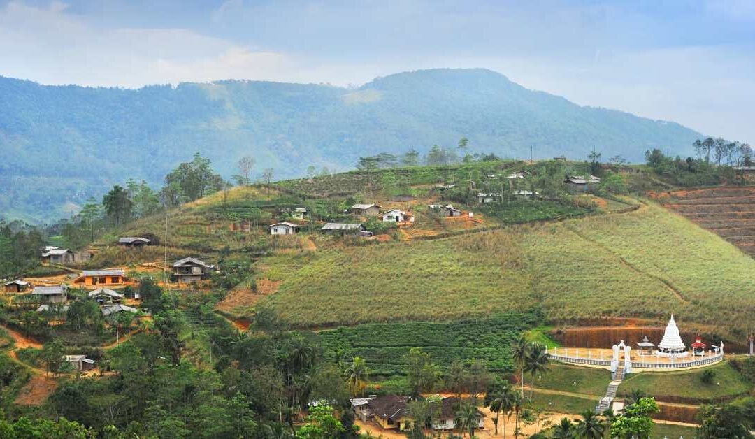
My first stop was a small village called Thangappuwa. This place feels like it is floating in the sky. Sometimes, the mist is so low that you feel like you are walking through a cloud. The houses are small and painted in bright colours. Every house has a garden full of vegetables.
The people here are very welcoming. Children wave at you, and the older people smile as if they know you. Life here is slow. Nobody rushes. Everything moves at the speed of the drifting mist.
Part 4: Day One – The Secret Village Trails
I started my exploration with a trail that was not on my map. A villager pointed to a narrow path behind some pepper vines and told me to go that way.
What to See in Thangappuwa
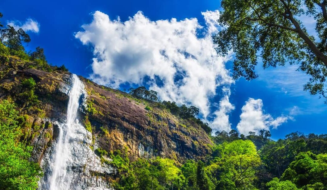
1. The Hidden Waterfall There is a waterfall here that has no name on the tourist maps. It looks like white lace falling over big rocks. You can hear the water before you see it. Unlike famous waterfalls that have viewing platforms and ticket counters, this one has nothing. It is just you, the rocks, and the cool spray of water.
2. The Moss Corridor I walked through a part of the forest where the trees were very old. Green moss covered everything—the tree bark, the stones, and the ground. It felt like a scene from a fairy tale. The air here is very fresh and rich with oxygen.
3. The Vegetable Terraces The farmers here grow leeks, carrots, and potatoes on very steep hills. The land looks like a patchwork quilt of different shades of green. It is amazing to watch them work on such steep slopes without falling.
What to Do
Walk the “Gama Para”: These are the small walking paths used by villagers. They take you through pine forests and farm fields.
Pick Fruit: If you ask politely, locals might let you pick wild guava or passionfruit from the vines.
Cloud Watching: Find a flat rock, sit down, and just watch the clouds move. They roll in like ocean waves.
Part 5: Day Two – Meemure, The Village of Legends
Meemure is a very isolated village. People say it is hidden behind the “last bend of civilization.” For a long time, there was no road to get here, only a footpath. Even today, phone signals rarely work here. This is the perfect place to disconnect from the internet and reconnect with nature.
To get to Meemure, I had to ride in a van that bounced over a very rough road. But the journey was worth it.
What to See in Meemure
1. Lakegala Mountain This is the most famous sight in Meemure. It is a triangular mountain that looks like a sharp spear pointing at the sky. There are many old legends about this mountain. Some say King Ravana (from the Ramayana epic) used it as a power source. It dominates the view; you can see it from almost everywhere in the village.
2. The Bamboo Forests Surrounding the village are tall groves of bamboo trees. When the wind blows, the bamboo stalks knock against each other, making a calming, hollow sound.
3. The Natural Infinity Pool There is a spot in the river where the water is calm and clear as glass. It forms a natural pool. You can swim here, and the water is incredibly refreshing.
What to Do
River Bathing: Put your feet in the cold river water. It feels great after a hot drive.
Traditional Cooking: Ask your homestay host to show you how to cook Jackfruit curry. They cook it slowly over a wood fire, which gives it a smoky, delicious taste.
Stargazing: At night, because there are no streetlights, the sky is filled with stars. You can see fireflies blinking in the bushes, mirroring the stars above.
Part 6: Day Three – More Places to Explore
While Thangappuwa and Meemure are amazing, the Knuckles area is huge. Here are more places you must see to get the full experience.
1. Riverston Peak (The Windy Gap)
Riverston is one of the most popular spots, but it is essential. You drive up a winding road to a place often called the “Windy Gap.”
The Experience: You have to get out of the car and walk the last few kilometres. The wind here is incredibly strong—sometimes strong enough to make you stumble!
The View: At the top, there are two tall communication towers. The view stretches all the way to the ocean on a clear day.
2. Pitawala Pathana (Mini World’s End)
This is a unique grassy plain on top of the mountain. It looks like a flat green table.
The Drop: You walk across the grass until you reach the edge. Suddenly, the land drops away in a sheer cliff. This is called “Mini World’s End.” It is a 750-meter drop.
Why go: It is an easy walk, not a difficult hike, and the views are panoramic.
3. Sera Ella Waterfall
This is one of the most beautiful waterfalls in Sri Lanka.
The Special Feature: What makes Sera Ella special is a rock cave located behind the falling water. You can walk into the cave and look out through the curtain of water. It is a magical experience to stay dry while the waterfall crashes down right in front of your face.
4. Manigala (The Time Rock)
If you like hiking, climb Manigala. Villagers used to use this mountain to tell the time by looking at the shadow it cast on the valley. The hike takes you through terrace rice fields and forest patches.
5. Sembuwatta Lake
This is a man-made lake created from natural spring water. It is surrounded by tea plantations and pine trees.
The Vibe: It looks a bit like a lake in Europe. It is very popular with local families. You cannot swim in the lake (it is too deep), but there is a swimming pool filled with spring water nearby.
Part 7: The Food of the Mountains
Mountain food in Sri Lanka is different from city food. It is simple, earthy, and very fresh.
Must-Try Meals:
Kurakkan Roti: A dark, firm flatbread made from finger millet. It is usually served with spicy coconut sambol (a mix of coconut, chili, and lime).
Clay Pot Rice: Rice cooked over firewood in a clay pot. The bottom layer gets crispy, which is the best part.
Kithul Treacle: This is a sweet syrup made from the Fishtail Palm tree. It tastes like smoky maple syrup. It is often poured over curd (buffalo yogurt).
Wild Bee Honey: Locals collect honey from the forest. It has a unique floral taste.
When you eat in the village, you eat with your hands. This is not just a custom; it actually makes the food taste better because you mix the curry and rice perfectly.
Part 8: Practical Tips for Travellers
Visiting the Knuckles range requires some preparation. Here is what you need to know.
1. The “Leech” Situation This is a rainforest area. When it rains, there will be leeches on the ground.
Don’t panic: They are harmless, just annoying.
The Solution: Wear long “leech socks” (you can buy them in Sri Lanka). You can also apply citronella oil or soapy water to your shoes to keep them away.
2. Weather Changes The weather here is unpredictable. It can be sunny one minute and misty the next.
What to pack: Bring a lightweight rain jacket and a warm sweater. The nights can get quite cold (around 15-18°C).
3. Respect the Culture The people in these villages are traditional.
Clothing: When swimming in the river near a village, it is polite to wear a t-shirt and shorts rather than skimpy swimwear.
Permission: Always ask before taking photos of people.
4. Best Time to Visit
January to March: This is generally the driest period and the best for hiking.
June to August: Also a good time, though it can be windy.
avoid: October and November are usually the rainy monsoon months. The trails become muddy and slippery.
A Gentle Reminder to Return
As I drove back toward Kandy, the mountains slowly became smaller in my rear-view mirror. But they did not feel far away. The feeling of the cool air and the silence stayed with me.
The “Knuckles 2.0” experience isn’t about conquering the highest peak. It isn’t about ticking a box on a list.
It is about:
Walking paths that only locals know.
Drinking hot tea in a small house under a Eucalyptus tree.
Hearing waterfalls that you didn’t plan to find.
Breathing air that is clean and pure.
I went there looking for hiking trails. I found villages, stories, silence, and peace.
If the classic Knuckles trip is a postcard you send to friends, then Knuckles 2.0 is a secret letter you keep for yourself. I hope one day you get to read it.
I arrived in Jaffna with salt on my skin and limestone dust on my shoes, though I didn’t know it yet. The north of Sri Lanka doesn’t announce itself with lush drama or postcard waterfalls. Instead, it whispers. It’s a place of porous stone and patient wells, of coastlines that look unfinished in the best possible way. Jaffna is shaped by limestone, and once you begin to notice it, everything from the caves to the wells to the quiet roads edging the sea starts to make sense.
This journey became less about ticking off sights and more about following trails that felt geological, cultural, and personal all at once.
Landing at Katunayake, Sri Lanka’s main international gateway, you’re still a long way from Jaffna—but it’s a satisfying journey north.
By Train: After reaching Colombo Fort from the airport, I boarded a northbound train that slowly traded city chaos for palmyrah palms and open sky. The rhythm of the tracks gave the journey a meditative quality, and arriving at Jaffna Railway Station felt like stepping into a different tempo of life.
By Road: If you prefer flexibility, the drive north is a long but fascinating cross-section of the island. Private taxis and self-driven routes pass ancient tanks, dry-zone forests, and roadside fruit sellers who seem to exist outside time.
By Domestic Flight: For those short on time, small aircraft connect the west coast to the north, offering aerial views of lagoons and salt pans that preview the landscape ahead.
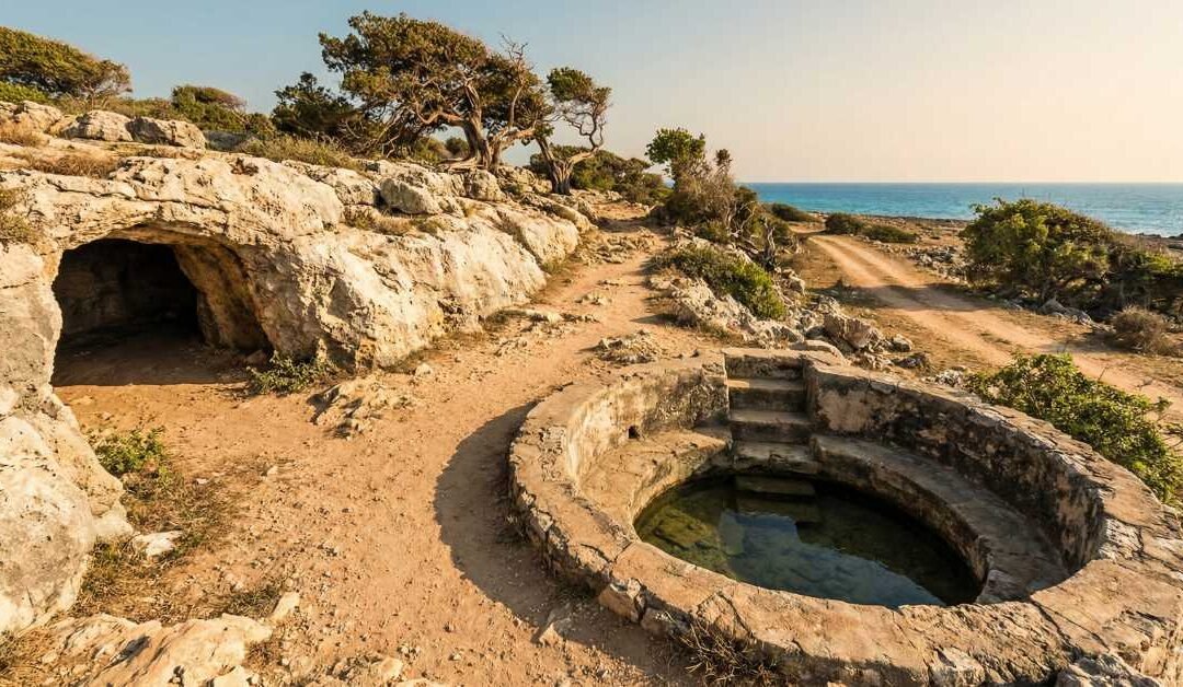
Jaffna sits on a limestone plateau, unlike the rest of Sri Lanka. There are no rivers here. Instead, rainwater disappears underground, stored in aquifers and drawn back up through wells that dot almost every household.
My first walk through the city revealed open wells at street corners, framed with stone or concrete, often decorated with flowers. These aren’t relics, they’re alive, functional, and central to daily life. Limestone gives, and Jaffna remembers.
A short journey from the city took me to the Nilavarai caves, one of Jaffna’s most intriguing geological features. From above, it looks like an unassuming circular pit. Peer inside, and the earth opens up.
Legend says the cave has no bottom. Science says otherwise—but neither explanation dulls the sense of mystery. The water below is impossibly still, reflecting the sky like a portal rather than a pool.
Standing there, I felt like I was at the edge of Jaffna’s subconscious. The limestone here doesn’t just hold water; it holds stories.
What to do: – Walk the perimeter slowly and observe how light shifts across the opening – Talk to locals who casually recount myths older than maps – Sit quietly, this is a place that rewards stillness
In most places, wells are utilitarian. In Jaffna, they’re architectural and social landmarks.
Some wells are circular, others square. Some are deep and shadowy, others shallow enough to glimpse the sandy bottom. Many homes still depend on them daily, drawing fresh water filtered naturally through limestone.
One afternoon, I followed a neighbourhood path that connected several wells like beads on a string. Children washed bicycles nearby. Elders chatted in the shade. It felt less like infrastructure and more like choreography.
What to see: – Traditional open wells in residential areas – Temple wells with carved stonework – Coastal wells where fresh water improbably exists near the sea.
Jaffna’s coastline doesn’t behave like the south’s. There are no dramatic cliffs or surf breaks demanding attention. Instead, there are paths—narrow, pale, and almost apologetic—running alongside the sea.
I walked one such path near Kankesanthurai, where limestone meets salt air. The ground crunched softly underfoot. Fishermen repaired nets beside boats that looked more sculpted than built.
These coastal trails feel forgotten not because they’re abandoned, but because they don’t ask to be noticed. And that’s their charm.
What to do: – Walk early morning or late afternoon when the light is kind – Watch birds skim low over tidal flats – Let yourself get lost—paths reconnect eventually.
A short crossing brought me to Kayts Island, where the limestone narrative continues with a maritime accent. Here, the land feels thinner, more porous, as if the sea is slowly reclaiming it grain by grain.
Old churches, quiet harbors, and wind-shaped trees give the island a contemplative mood. The roads are narrow, the horizons wide.
Jaffna Fort rises from the ground like it grew there, its coral-limestone walls glowing softly in the afternoon sun. Built, fought over, abandoned, and reclaimed, the fort is a crash course in colonial history compressed into stone.
Inside, the wind carries the smell of the sea and something older—time itself, perhaps.
Nearby temples echo this sense of endurance. Limestone foundations support vibrant rituals, proving that geology and belief are often collaborators.
When I left Jaffna, it wasn’t with the usual collection of dramatic photos. Instead, I carried textures: chalky dust on my hands, cool stone under my feet, the quiet echo of water far below ground.
The limestone trails of Jaffna don’t shout for attention. They wait.
And if you follow them through caves, past wells, and along forgotten coastal paths—you’ll find a version of Sri Lanka that doesn’t try to impress, only to endure.
I didn’t plan to learn the social structure of a Sri Lankan village from a boutique, but that’s how it happened. Not from a council meeting, not from a newspaper, not even from a temple sermon—but from a small roadside shop no bigger than a living room, where biscuits were stacked like architecture and gossip moved faster than electricity.
In Sri Lanka, the boutique is not just a shop. It is a newsroom, a parliament, a notice board, and sometimes a courtroom. And once you start paying attention, you realize that almost everything worth knowing passes through it.
My education began on a plastic chair outside a village boutique somewhere between paddy fields and a road that only pretended to be straight. I had stopped for water and shade. What I stayed for was the conversation.
A motorbike arrived. Engine off. Helmet removed. News delivered.
Someone’s cousin had returned from the Middle East. A bus had broken down near the junction. The price of coconuts was behaving strangely again. None of this was announced formally. It was released, gently, into the air—like incense.
I hadn’t even opened my bottle yet, and already I knew more about the village than any map could tell me.
A Sri Lankan boutique is rarely silent. Even when no one is speaking, something is happening. A radio hums. A kettle rattles. Coins clink against the counter with a familiarity that suggests they’ve lived here their entire lives.
The shopkeeper—usually seated, sometimes standing, always watching—is the quiet axis around which everything turns. They don’t interrupt. They don’t editorialize much. They absorb.
If the village had a memory, the boutique would be it.
Here, community news doesn’t arrive in headlines. It arrives in fragments—a sentence cut short; a raised eyebrow; a pause that lasts half a second too long.
You learn quickly that what isn’t said often matters more than what is.
The word “gossip” feels unfair here. What happens in a boutique is closer to information management.
Yes, people talk about people—but they also talk for people. News travels fast because it needs to. Someone is sick. Someone needs help. Someone’s roof didn’t survive the rain. The boutique is where this information becomes collective responsibility.
I watched a conversation unfold once where a woman mentioned—casually, almost accidentally—that her neighbor hadn’t opened their shop that morning. Within minutes, someone had decided to check in. Another offered to bring food. A third nodded and said nothing, which meant they would handle the rest.
Morning gossip is practical. Who left early. Which bus was late. Whether the road ahead is flooded or merely pretending to be. Farmers exchange updates that sound vague but are actually precise. A single comment about the wind direction can carry an entire weather forecast.
Evening gossip is reflective. This is when stories stretch their legs. When past events are re-examined, sometimes gently corrected, sometimes dramatically improved.
I learned quickly that if you want facts, come early. If you want truth, come late.
Almost every boutique has a bench or two outside—plastic, wooden, or improvised from something that once had another purpose. These benches are not seating. They are membership.
Sit too confidently, and you’re suspicious.
Sit too hesitantly, and you’re invisible.
I learned to sit like someone waiting for something, even when I wasn’t sure what that was. It worked. People spoke around me at first, then to me, then—eventually—through me, using me as a neutral audience to float half-formed opinions.
The relationship between the boutique and the temple is an interesting one. One handles the spiritual order. The other handles everything else.
Festival dates, almsgiving plans, procession routes—all of it gets confirmed at the boutique before it becomes official. If the temple is the heart, the boutique is the circulatory system.
I once watched a disagreement about a festival schedule get resolved not at the temple, but over tea beside a biscuit display. The conclusion was never announced. It simply took effect.
Politics enters the boutique the way spice enters Sri Lankan food: deliberately and with restraint.
No one shouts. Opinions are tested lightly, like tapping a coconut to see if it’s good. A comment is made. A pause follows. If no one reacts, the subject changes.
If someone reacts, the conversation deepens—but never too far. The boutique values harmony over victory. Arguments here are softened by laughter, redirected by tea, or postponed indefinitely.
I realized that the boutique isn’t a place for being right. It’s a place for remaining connected.
Children treat the boutique like a headquarters. They arrive in groups, buy one thing collectively, and leave with several pieces of information they weren’t looking for.
They know who’s visiting. Who’s fighting. Who’s pretending not to talk to whom.
By the time they grow up, they’ve already completed an informal degree in social navigation.
Watching this, I understood how village knowledge survives generations without being written down.
As a traveler, I was always being evaluated—kindly, subtly, constantly.
The boutique is where that evaluation happens.
Do you greet people? Do you wait your turn? Do you listen more than you speak?
Answer correctly, and the village opens up. Homes become accessible. Stories become personal. You stop being “the visitor” and start being “the one who sat there that day.”
Fail, and you’ll still be treated politely—but the deeper layers remain closed.
By the time I left the village, I realized I hadn’t just learned about gossip or community news. I had learned about trust.
The boutique works because people return. Because they speak carefully. Because they understand that words, once released, don’t belong to them anymore.
In a world obsessed with speed and volume, the Sri Lankan village boutique offers something radical: attention.
It doesn’t amplify voices. It balances them.
And if you’re lucky enough to sit on the right bench at the right time, you’ll hear the real story—not shouted, not announced, but passed gently from one human to another.
That, more than anything I saw on this journey, felt like the true heart of the village.
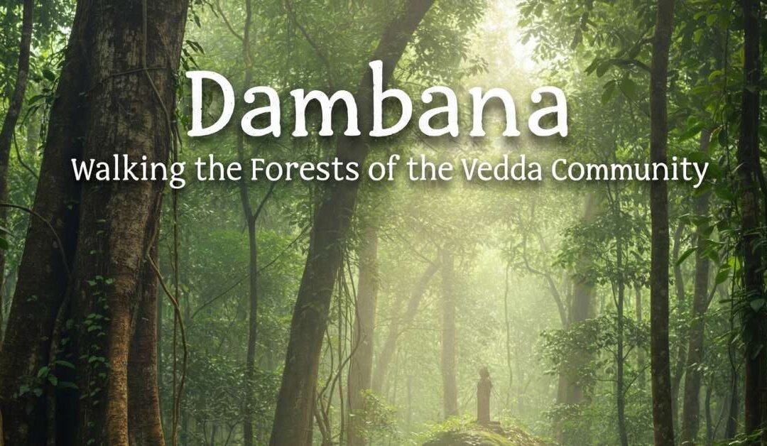
If you’ve read about Dambana before, chances are it was framed as a headline—Sri Lanka’s last indigenous tribe, vanishing culture, ancient people in a modern world. I arrived carrying those phrases like luggage I didn’t realize I’d packed. It took only a few hours in Dambana for them to feel inadequate, even clumsy.
Dambana is not a museum. It is not a performance. And it is certainly not frozen in time.
It is a living forest landscape where tradition and adaptation exist side by side, where the Vedda community navigates the present without abandoning the past. Walking these forests, I realized how little headlines tell you—and how much the land itself is willing to teach, if you slow down enough to listen.
First Steps into Dambana: Leaving the Noise Behind
The road into Dambana narrows gradually, as if easing you out of the modern world rather than cutting it off abruptly. Concrete gives way to red earth. Shops thin out. Forest edges creep closer to the road. The air changes—cooler, earthier, carrying the scent of leaves and dry wood.
Dambana lies near Mahiyanganaya, in Sri Lanka’s Uva Province, bordered by forest reserves and reservoirs. It’s not remote in the way maps suggest, but it feels remote because it operates on a different rhythm.
When I arrived, there was no dramatic entrance. No gates. No sense of crossing into something exotic. Life was simply happening—people talking, children moving between houses, smoke curling gently from cooking fires.
That ordinariness was the first lesson.
Understanding Dambana Without Oversimplifying It
The Vedda people are often described as Sri Lanka’s indigenous community, but that label barely scratches the surface. Today’s Vedda families live across a spectrum—from those maintaining forest-based traditions to those navigating education, agriculture, and modern livelihoods.
Dambana itself reflects that diversity. You’ll see traditional leaf huts alongside permanent homes, elders dressed in customary styles, and younger generations wearing everyday modern clothing. This coexistence isn’t contradiction—it’s continuity.
What struck me most was how deeply the forest remains embedded in daily life, not as a romantic symbol, but as a practical, spiritual presence.
What to Do: Experiences Rooted in Respect
Walk the Forest with Local Knowledge
Walking through the forest with a Vedda guide is unlike any nature walk I’ve done before. This isn’t about pointing out animals for photos—it’s about reading the land.
Every tree has a use. Every plant tells a story. You’ll learn how honey is traditionally gathered, how medicinal plants are identified, and how the forest provides without being exhausted. The knowledge is layered, observational, and deeply ecological.
You begin to see the forest not as wilderness, but as a lived-in space.
Listen to Oral Histories
Some of the most powerful moments in Dambana happen sitting still. Stories are shared not as performances, but as conversations—about ancestors, changes to the land, displacement, adaptation, and survival.
These stories aren’t always comfortable. They challenge romantic narratives and remind you that preservation often comes with loss.
Observe Traditional Practices (When Appropriate)
Depending on the time and context, you may witness demonstrations of hunting techniques, honey collection methods, or traditional tools. These moments are best approached with humility—observe, don’t interrupt, and avoid turning them into spectacles.
Photography, if allowed, should always be secondary to presence.
Walk Without an Agenda
Dambana rewards unstructured time. Walking between homes, observing daily routines, watching children play at the forest’s edge—these moments reveal more than any curated experience.
What to See: A Landscape Shaped by Memory
The Dry-Zone Forest
Dambana sits within Sri Lanka’s dry-zone ecosystem, where tall trees, scrub forest, and open clearings coexist. During certain times of year, the forest feels stark and sunlit; at other times, it hums with life and green intensity.
The land here carries traces of ancient paths, old settlements, and shifting boundaries—evidence of long human presence.
Reservoir Views and Open Clearings
Nearby reservoirs and open plains offer expansive views that contrast with the intimacy of the forest. Standing at these edges, you can see how development, conservation, and community life intersect—sometimes uneasily.
Everyday Life
The most meaningful sights aren’t landmarks. They’re moments: a family preparing food, elders talking quietly in the shade, tools leaning against a tree, smoke drifting upward at dusk.
These scenes resist being framed neatly—and that’s their power.
Where to Stay: Close Enough to Listen
There are no conventional hotels within Dambana itself, and that’s intentional. Staying nearby allows for respectful engagement without turning the village into a tourist zone.
Mahiyanganaya
The most common base, offering guesthouses and small hotels within easy reach of Dambana. Staying here provides comfort while allowing early starts and guided visits into the community.
Eco-Lodges Near the Forest Edge
Some accommodations near Dambana focus on sustainability and nature immersion. These places tend to emphasize quiet, local food, and environmental awareness—an ideal fit for the experience.
Village-Style Stays
In certain cases, arrangements can be made for culturally appropriate homestays through local coordinators. These require sensitivity and clear communication but can offer deeper insight into daily life.
Wherever you stay, the goal is proximity without intrusion.
How to Get There from Katunayake Airport
Reaching Dambana is straightforward, though it requires patience and planning.
By Car
From Katunayake Airport, travel toward Colombo, then continue to Kandy and onward to Mahiyanganaya. From there, Dambana is a short drive inland. This route offers scenic transitions from urban centers to hill country and finally to dry-zone forest.
A hired vehicle with a knowledgeable driver is often the most convenient option.
By Train + Road
Take a train from Colombo Fort to Kandy. From Kandy, continue by car or bus to Mahiyanganaya, then onward to Dambana. This option allows you to break the journey and experience central Sri Lanka along the way.
By Bus
Long-distance buses run from Colombo to Mahiyanganaya. From there, local transport can take you closer to Dambana. While slower, this route offers a grounded view of everyday Sri Lankan travel.
Visiting with Awareness: What Matters Most
Dambana is not a place to consume—it’s a place to encounter. That distinction matters.
Seek permission before photographing people.
Avoid intrusive questions or assumptions.
Listen more than you speak.
Understand that not every tradition is for display.
The Vedda community has spent decades being observed, documented, and discussed. Respect begins with recognizing that you are a guest, not an interpreter of their story.
When to Visit: Reading the Seasons
Dambana can be visited year-round, but the experience shifts with the seasons.
Dry months offer easier forest walks and clearer conditions.
Greener periods bring lush vegetation and a deeper sense of forest vitality.
Early mornings and late afternoons are best for walking, when the heat softens and the forest feels most alive.
What Dambana Really Gave Me
I arrived in Dambana expecting to learn about a community. I left having learned something about attention.
In the forest, everything requires care—where you step, what you touch, how you listen. The Vedda way of life, shaped by observation and restraint, feels quietly radical in a world built on extraction and speed.
Dambana doesn’t ask to be preserved as an image of the past. It asks to be understood as a present—complex, evolving, and deeply connected to land.
And perhaps that’s the real story beyond the headlines: not a culture vanishing, but one insisting on being seen on its own terms.
Walking away from Dambana, the forest closed behind me gently, as if nothing had happened at all. But something had. I had learned that travel doesn’t always expand your world by adding places—it does so by stripping away assumptions.
And Dambana, in its quiet clarity, does exactly that.
Ancestral Echoes: The History They Don’t Teach in Schools
To walk through Dambana is to walk through a timeline that predates the arrival of North Indian settlers in the 5th century BC. While traditional Sri Lankan history often begins with the arrival of Prince Vijaya, the Vedda—or Wanniyala-Aetto (meaning “forest-dwellers”)—have roots stretching back to the island’s Neolithic era.
The Legend of Kuveni and the Dual Heritage
Local lore often connects the community to Kuveni, the indigenous queen who encountered Vijaya. When she was later cast aside, her children are said to have retreated into the forests of the central plains, becoming the progenitors of the modern Vedda. This duality—being the “original” inhabitants while existing on the margins of the recorded state—defines much of their identity.
In Dambana, history isn’t found in books; it’s etched into the names of rock outcrops and the oral genealogies recited by elders. You realize quickly that their history is one of persistence. Despite centuries of colonial pressure (Portuguese, Dutch, and British) and post-colonial assimilation policies, the core of their identity remains tethered to the dry-zone canopy.
The 1983 Turning Point
Perhaps the most significant chapter in Dambana’s recent history is the creation of the Maduru Oya National Park in 1983. For the Vedda, this was a moment of profound displacement. Families who had lived as hunter-gatherers were restricted from their traditional hunting grounds in the name of conservation.
Understanding this tension is vital for any visitor. When you see a Vedda elder looking toward the horizon of the park, they aren’t just looking at “nature”; they are looking at a home that became a restricted zone overnight. This historical context transforms your visit from a simple “cultural tour” into a witness of a community’s resilience in the face of modern environmental policy.
The Language of the Forest: More Than Just Words
One of the most subtle experiences in Dambana is the sound of the Vedda language. While many community members are bilingual in Sinhala, they maintain a distinct dialect that is a linguistic treasure.
The vocabulary is a reflection of their environment. Unlike modern languages that categorize nature into “resources,” the Wanniyala-Aetto dialect uses terms that imply a familial relationship with the wild.
Poda (The Child): Often used in various forms to describe the young of both humans and animals, blurring the line between the species.
Kola-Rila (Leaf-dweller): A name for the monkey that describes its function and habitat rather than just a taxonomic label.
When you sit with a guide, ask about the names of the trees. You’ll find that a single tree might have different names depending on whether it is being used for medicine, for its fruit, or for its shade. This isn’t just “vocabulary”; it is a map of survival.
The Wisdom of the Harvest: Honey and Healing
In Dambana, the most respected skill isn’t how much you own, but how well you know the “timing” of the forest. Two practices stand out: Honey Gathering and Indigenous Medicine.
The Brave Harvest of the Bambara
Honey is the lifeblood of the Vedda. The Bambara (giant honey bee) builds massive combs on high rock faces and the limbs of tall trees. Watching or hearing about a honey-gathering expedition is a lesson in extreme bravery and spiritual permission.
The gatherers use a traditional vine ladder (mabu) and smoke torches made of specific leaves to calm the bees. But before a single drop is taken, a ritual of permission is performed. They believe the honey belongs to the forest spirits; they are merely borrowing it.
The Forest Pharmacy
The Vedda’s knowledge of Hela Wedakama (indigenous medicine) is staggering. During your walk, your guide might point out:
Bin Kohomba: A tiny plant used to treat fevers and digestive issues.
Aralu, Bulu, and Nelli: The “triphala” fruits, used for everything from skin ailments to longevity.
This isn’t “alternative” medicine here; it is the primary healthcare system. It’s important to realize that the conservation of the forest is, for the Vedda, the conservation of their pharmacy.
Spiritual Landscapes: The Nae Yakku
To understand the Vedda, you must understand their relationship with the Nae Yakku (Ancestral Spirits). They do not view the dead as “gone”; the ancestors are believed to inhabit the trees, the rocks, and the streams.
The Kiri Koraha Ritual
If you are fortunate enough to witness a Kiri Koraha (milk dance), you aren’t seeing a performance for tourists. It is a sacred invocation. Dancers move to the rhythm of a drum, entering a trance-like state to communicate with the spirits of great hunters and leaders of the past.
They offer “coconut milk” as a symbol of purity and life. For the traveller, this is a reminder that the forest isn’t “empty” space—it is a crowded, spiritual realm where the past is always present.
Practical Guide: Expanding Your Journey
To make the most of your trip to the Uva Province, it helps to see Dambana as part of a larger, interconnected landscape.
Nearby Landmarks to Complement Your Visit
Location
Distance from Dambana
Why Visit?
Sorabora Wewa
~15 km
An ancient reservoir built during the reign of King Dutugemunu. The sluice gate is a marvel of ancient engineering.
Mahiyangana Raja Maha Vihara
~18 km
One of the 16 most sacred Buddhist sites in Sri Lanka. It provides a fascinating contrast between the forest spirits and formal Buddhism.
Rathna Ella Waterfall
~25 km
A stunning, less-visited waterfall. The trek to the base is rugged and beautiful, reflecting the wildness of the region.
Financial Transparency and Ethics
When visiting Dambana, you will likely be asked to pay a fee for a guide or for entry to the local museum.
The Museum: There is a small, community-run museum in Dambana that houses traditional tools, bows, and historical photos. The entrance fee goes directly toward village upkeep.
Tipping: If a guide spends three hours showing you the secrets of the forest, a generous tip is appropriate, but it should be given discreetly.
Purchasing: You may find local honey or hand-carved bows for sale. Ensure these are authentic and made by the community. Buying these is a direct way to support their traditional livelihoods.
Deep Packing List for the Dry Zone
Dambana’s climate can be punishing if you aren’t prepared. The dry-zone heat is “heavy” and humid.
Earth-Toned Clothing: Bright “safari” neon colors are distracting. Wear greens, browns, or greys to blend into the forest environment.
Leech Protection (in the rainy season): If it has rained recently, the forest floor comes alive. High socks and leech lime are essential.
A Small Notebook: You will hear stories and names of plants that Google cannot provide. Write them down.
Water Purification: Avoid bringing excessive plastic bottles into the village. Carry a filtered bottle if possible.
The Modern Vedda: A Living Evolution
A common mistake travellers make is feeling “disappointed” if they see a Vedda youth using a smartphone or wearing a t-shirt. This is a trap of the “noble savage” myth.
The Vedda are not a people out of time; they are a people managing time. Many young Veddas attend school in Mahiyanganaya, pursue university degrees, or work in agriculture. They are fighting for land rights using the legal system while still knowing how to find water in a dry riverbed.
By engaging with the younger generation, you learn about their struggle to balance heritage with the demands of the 21st century. This conversation is often more “real” than any demonstration of fire-making.
The Gift of Silence
The greatest “useful information” I can give a traveller visiting Dambana is this: Be comfortable with silence. In the forest, the Vedda often fall silent. They are listening—not for anything specific, but for the general “mood” of the woods. As a visitor, your instinct will be to fill the air with questions. Resist it.
Walk for thirty minutes without saying a word. Watch how your guide moves. Watch how they avoid stepping on certain roots. In that silence, the “information” you are looking for—the true essence of Dambana—will finally reveal itself. It isn’t something that can be told; it is something that must be felt through the soles of your feet and the stillness of your breath.