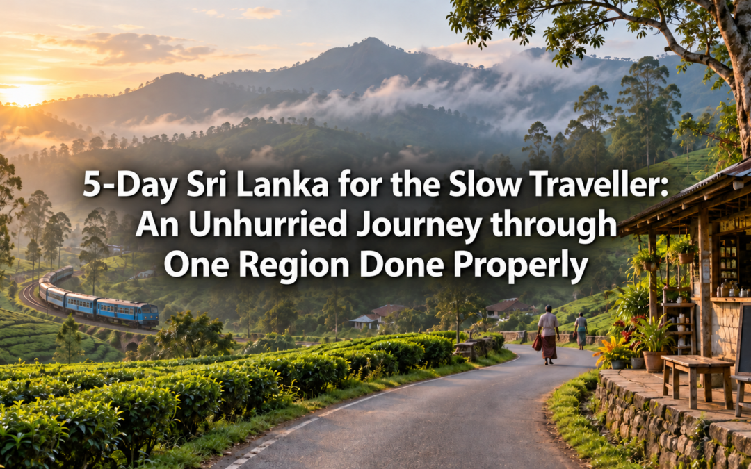
5-Day The Rubber and Gem Belt: An Inland Journey through Ratnapura and Kalutara

5-Day The Rubber and Gem Belt: An Inland Journey through Ratnapura and Kalutara

Almost every Sri Lanka itinerary runs along the coast or climbs into the tea highlands. The interior lowlands of Sabaragamuwa Province, sitting between the two, are passed over almost entirely. There are no famous beaches here, no hill-country viewpoints, no Instagram landmarks. What there is, is a working landscape of considerable depth and character. Rubber estates stretching across low rolling hills. Rivers carrying sediment down from the central highlands, sediment that happens to contain some of the finest gemstones in the world. Open-air markets where sapphires and rubies are traded daily with a handshake and a shared vocabulary of weights and qualities that has been in use for generations.

This is Sri Lanka’s interior economy, visible and unhurried and entirely unperformed for the benefit of visitors. Five days through it will show you a version of the island that most travellers never reach, and that is precisely the point.

Day 1 — Kalutara and the River Mouth

Begin in Kalutara, about an hour south of Colombo on the coastal road. Most people know it only as a place they drive through on the way to Galle, registering the white dagoba visible from the highway and moving on. That dagoba, the Gangatilaka Vihara, sits at the mouth of the Kalu Ganga river and is worth more than a passing glance. It is hollow, which is unusual among Sri Lankan stupas, and the interior is painted with scenes from the Jataka tales in a style that is vivid and slightly naive and completely absorbing.

The Kalu Ganga itself is the real introduction to this journey. The river drains a significant portion of the wet zone interior, and at its mouth in Kalutara it is wide, slow, and brown with the silt it has carried down from the highlands. Hire a boat for a morning on the river. The mangrove channels along the northern bank support a dense and varied birdlife, and the transition from the tidal estuary to the freshwater upper reaches, where the rubber estates begin appearing on the banks, happens gradually and visibly over the course of an hour.

For accommodation in Kalutara, Tangerine Beach Hotel is a comfortable mid-range option with a good beachfront location and easy access to the river. For a more intimate stay, Paradise Road The Villa Bentota, a short distance south, offers beautifully designed boutique accommodation in a restored colonial property.

Day 2 — Into the Rubber Country

The rubber estates begin properly about twenty kilometres inland from Kalutara, and the landscape they create is one of the more unusual in Sri Lanka. Rubber trees are planted in long, even rows, their trunks pale and smooth, the canopy they form overhead dense enough to block most of the sky. Walking through a mature rubber estate in the early morning, when the tappers are at work scoring the bark in long diagonal cuts and the latex is running white and slow into small collection cups, has a quiet, methodical beauty to it.

Rubber tapping begins before dawn and is largely finished by mid-morning, because the latex flows best in the cooler hours. If you want to see it properly, you need to be in the estates by six at the latest. Ask your guesthouse the evening before to arrange access to a working estate. Most of the larger properties in this area have relationships with nearby estates and can make the introduction without difficulty.

The rest of the morning is well spent on the back roads between Kalutara and Ratnapura, a drive of around two hours that passes through a succession of small towns and village markets. The produce along this stretch reflects the wet zone economy honestly: bunches of king coconut stacked at the roadside, jak fruit the size of small children hanging from the trees in home gardens, pepper vines climbing jak trunks in plots that have been producing for four generations. Stop when something catches your attention. That is the correct way to travel this road.

Day 3 — Ratnapura and the Gem Trade

Ratnapura means City of Gems in Sinhala, and the name is not an exaggeration. The district sits at the edge of the wet zone, where the rivers coming off the central highlands deposit the gravel beds in which sapphires, rubies, cat’s eyes, alexandrite, and dozens of other precious and semi-precious stones are found. Sri Lanka has been a source of gemstones for over two thousand years. The island is mentioned in ancient Silk Road trading records as a supplier of sapphires, and the tradition of the gem trade here has a continuity and a depth that is palpable if you spend any time in the town.

The open-air gem market near the Ratnapura bus station is the place to start. It operates through the morning hours and has a straightforward, untheatrical quality that is immediately engaging. Dealers sit in small groups, passing stones between them, holding them up to the light, negotiating in low voices. The transactions are small and large simultaneously, a rough stone changing hands for a few hundred rupees that might, once cut and polished, be worth considerably more. Nobody is performing for you. This is simply how business is done here, as it has been done for centuries.

Several licensed gem museums and mining operations around Ratnapura offer guided visits to active mine sites. The mining itself is low-tech and labour-intensive: shallow pits dug into the gravel beds, the excavated material washed through wooden sluices, the workers picking through the concentrate by hand and eye. It is not spectacular, but it is genuine, and watching someone find a rough sapphire in a pan of gravel and hold it up to the light with the same quiet satisfaction that this gesture must have produced two thousand years ago is not something you forget quickly.

For accommodation in Ratnapura, Ratnaloka Tour Inn is a well-established mid-range hotel with a good restaurant and staff who are genuinely knowledgeable about the gem trade and can arrange mine visits and market introductions. For budget travellers, Nilani Lodge offers clean, simple rooms at very reasonable prices in a central location.

Day 4 — The Sinharaja Buffer Zone and the Forest Edge

The southern edge of the Sabaragamuwa interior brings you to the boundary of Sinharaja, the last primary rainforest in Sri Lanka, and the buffer zone villages that exist in the transition between the forest and the farming landscape are worth a day of careful attention.

These villages have a relationship with the forest that is practical and ancient simultaneously. They collect non-timber forest products, rattan and medicinal plants and wild fruits, from the buffer zone under a system of community management that has kept the boundary more or less stable for generations. The farming in the buffer zone itself is characterised by a kind of productive disorder that is actually highly sophisticated: home gardens that layer fruit trees, spice plants, vegetables, and cash crops in a vertical system that mimics the structure of the forest and makes use of every available level of light and moisture.

A morning walk through one of these villages with a local guide is a genuinely educational experience. The guide will point out plants that you have walked past a dozen times without recognising as food or medicine, and the density of useful species in what looks like an ordinary garden will begin to seem extraordinary by the end of the walk.

In the afternoon, if the season is right, the Sabaragamuwa interior offers excellent birding along the forest edge. The transition zone between forest and farmland typically supports a higher diversity of bird species than either habitat alone, and the endemics that are more commonly associated with Sinharaja are frequently visible here without the cost or bureaucracy of a formal park entry.

Day 5 — The Kalu Ganga Upstream and the Return

Spend the final morning on the upper Kalu Ganga, upstream from Ratnapura where the river is narrower and faster and the surrounding hills are still largely forested. A local boatman can take you upstream for an hour or two through a landscape that sees very few visitors and has a raw, unhurried beauty that is different in character from anything on the coastal or highland routes.

The drive back to Colombo from Ratnapura takes around two hours on the main A8 road, which climbs briefly over a low pass before descending to the coastal plain. The transition is abrupt and instructive. One moment you are in the wet zone interior, surrounded by rubber and jak and the particular green of a landscape that has never been dry. Then the road drops, the vegetation changes, the sea appears in the distance, and the interior closes behind you like a door.

Stop at the Belilena Cave on the outskirts of Ratnapura before you leave. It is one of the most significant prehistoric sites in Sri Lanka, occupied by humans over thirty thousand years ago, and it sits in a limestone outcrop above a small river with a complete lack of ceremony that is either disappointing or refreshing depending on your temperament. There is no visitor centre, no interpretive board, no entrance queue. Just a cave, a river, and thirty thousand years of human habitation that nobody is making a particular fuss about.

Where to Stay

In Kalutara, Tangerine Beach Hotel handles mid-range comfort well, while Paradise Road The Villa Bentota suits those looking for something more considered. In Ratnapura, Ratnaloka Tour Inn is the best all-round choice for mid-range travellers, combining comfort with genuine local knowledge. Budget travellers are well served by Nilani Lodge, which is clean, central, and reasonably priced.

5-Day The River and the Rice: A Journey through Ampara and the Gal Oya Settlements

5-Day The River and the Rice: A Journey through Ampara and the Gal Oya Settlements

The Ampara district sits in the eastern lowlands of Sri Lanka, bounded by the Gal Oya river system to the north and the dry zone scrub forest to the south, in a landscape that looks, from a moving vehicle on the main road, like undifferentiated agricultural flatness. That impression is wrong in the specific way that most first impressions of planned agricultural landscapes are wrong, the visible surface of paddy fields and straight irrigation channels concealing a social and historical complexity that only slowing down and staying for several days begins to reveal.

This is one of the most deliberately constructed agricultural landscapes in post-independence Sri Lanka, the Gal Oya irrigation scheme of the 1950s creating an entire district’s worth of farming communities from scratch, relocating families from the densely populated wet zone into jungle cleared by the state and made farmable by the new reservoir and its canal network. The communities that resulted, Muslim and Sinhalese settler villages existing alongside pre-existing Tamil communities, have built something genuinely distinct in the decades since, a culture that is simultaneously rooted in the traditions its founding families brought from elsewhere and shaped by the specific conditions of the landscape they were placed in.

Five days here covers the paddy farming communities of the Ampara basin, the irrigation infrastructure that made them possible, and the markets and food culture of a district that the east coast tourism economy, now building steadily around Arugam Bay to the south, has not yet reached.

Day 1 — Arriving in Ampara

Ampara town sits roughly six hours from Colombo via the expressway and the Mahiyanganaya road, the approach from the west descending from the foothills through the outer margins of the Gal Oya system before the flat agricultural landscape of the basin proper opens around you. The town itself is a functional administrative centre with a mixed population, its market streets reflecting the demographic variety of the surrounding district in a way that is immediately apparent if you walk through them with any attention.

Arrive by early afternoon and spend the remaining daylight at the Ampara Market, one of the more varied and honestly stocked markets in the eastern province. The produce section reflects the agricultural economy of the surrounding settlements directly, paddy and dried rice products alongside the vegetables grown in the smaller home plots that supplement the main cereal farming. The dried fish section carries varieties specific to the eastern lagoon and coastal fisheries, and the small spice stalls carry produce from the home gardens behind the main farming operations that most outsiders never know exist.

For dinner, Hotel Monty on the main street serves a reliable rice and curry from six in the evening, the kitchen rotating its accompaniments with the day’s market supply and the fish preparation consistently reflecting the eastern Sri Lankan style, heavier on spice and tangier in flavour than the coastal preparations further south. For accommodation, Hotel Ampara on the central road offers clean, comfortable mid-range rooms at around three thousand five hundred rupees per night, the most reliable option in the town centre. For budget travellers, Green Land Guest House near the bus stand provides basic rooms at around two thousand rupees with a helpful owner whose knowledge of the surrounding district is worth considerably more than the room rate.

Day 2 — The Gal Oya Irrigation Infrastructure

Spend the day understanding the physical infrastructure that made the Ampara settlements possible, beginning with the Inginiyagala Dam at the southern end of the Senanayake Samudra reservoir, the engineering structure whose construction in 1950 created the water supply for the entire Gal Oya scheme. The dam itself is a mid-twentieth century engineering project rather than an ancient monument, but it sits within the same dry zone logic that shaped the ancient tank system of the cultural triangle, water gathered, stored, and distributed to make agriculture possible in a landscape that would otherwise support neither.

Drive the main canal roads that distribute water from the reservoir through the settlement grid, the irrigation channels running at right angles to the paddy fields in a pattern that reflects the planned origin of this landscape as clearly as any document could. The channels are maintained collectively by the farming communities they serve, the tradition of communal water management that the ancient irrigation civilisation established continuing here in a modern institutional form that looks different on the surface but operates on the same fundamental principles.

The Ampara Irrigation Office, accessible in the town centre, has historical records and maps of the scheme’s development that the staff are generally willing to share with genuinely interested visitors. The maps in particular, showing the progression of settlement from the initial clearing in the early 1950s to the fully developed agricultural grid of the present, give a compressed picture of how this landscape was constructed that no amount of looking at the current fields can quite replicate.

For lunch near the dam, the small restaurants in Inginiyagala town serve a rice and curry from eleven that reflects the surrounding farming community’s dietary staples with complete directness. The dhal here is made fresh daily and the coconut sambol ground that morning, details that matter considerably more than they might appear to.

Day 3 — The Settler Villages

The villages established under the Gal Oya scheme have, in the seven decades since their founding, developed a community character that is simultaneously shaped by the traditions the founding families brought from the wet zone and by the specific conditions of the dry zone landscape they were placed in. Spend the full day moving through two or three of the original settlement villages, approaching through introductions arranged by your accommodation rather than arriving unannounced.

The Sinhalese settler villages and the Muslim communities that were established alongside them exist in a proximity that the original settlement planners intended as a model of multi-ethnic coexistence and that has been tested, at various points in the district’s history, by the same communal tensions that affected the rest of the country. The communities that have come through those tensions and continued farming the same adjacent land have a relationship with their landscape and with each other that is considerably more complex than the planned agricultural grid they live within suggests.

The older settlers, the ones who came as children or young adults with the original scheme and remember the initial clearing of the jungle, have stories about this landscape that are irreplaceable and becoming rarer as that generation ages. Their grandchildren, born here and knowing no other home, have a completely different relationship to the same land, and the conversation between these two relationships is one of the more interesting things you can encounter in the Ampara basin if you create the conditions for it.

For lunch in one of the settler villages, the community women’s groups that operate informal catering for occasional visitors through several of the village cooperative structures can arrange a home-cooked meal using produce from the surrounding home gardens and the most recent paddy harvest. This requires advance arrangement through your accommodation, a day’s notice minimum, and the meal, rice and three or four accompaniments prepared in a domestic kitchen rather than a restaurant, reflects the actual food culture of the settlement community rather than any adjusted version of it.

Day 4 — The Weekly Markets and the Food Culture

The weekly markets of the Ampara district are one of the most direct windows into the economic and social life of the basin settlements, each one drawing farmers and traders from the surrounding villages on a fixed day that the entire community organises its week around. Confirm the market schedule for the surrounding villages through your accommodation and plan this day around whichever market falls on the right day.

The Uhana Market, held weekly and drawing communities from both the settlement villages and the older Tamil farming communities to the east, is one of the more varied in the district, the produce section reflecting the full range of what the basin’s different agricultural traditions grow. The Muslim community stalls carry dried goods and spices from the home garden tradition that has adapted to the dry zone conditions with considerable ingenuity, and the rice variety sold by the older Sinhalese settler families reflects cultivation choices made deliberately to suit the specific soil and water conditions of the Gal Oya fields.

Spend the full morning at whichever market is running, moving through the stalls without any purchasing agenda beyond genuine curiosity about what is being sold and where it comes from. The conversations that happen around market stalls, between sellers and regular buyers who have been trading with each other for years, are the most honest expression of community economic life available to an outside visitor and worth listening to even if the language makes full comprehension impossible.

For lunch after the market, eat at whatever the nearest roadside establishment offers, the meal a direct extension of what the morning’s market produced, simple and unmediated and entirely sufficient.

Day 5 — The Paddy Fields at Harvest

If your visit coincides with the paddy harvest season, the Ampara basin offers one of the most visually compelling agricultural landscapes in Sri Lanka, the fields cut and the rice spread to dry along every available road margin and flat surface, the smell of fresh-cut paddy carrying across the entire district in a way that makes the season immediately recognisable even before you see the fields themselves.

Outside of harvest season, the fields in their growing phase have their own qualities worth observing, the different shades of green at different stages of growth creating a textured, varied landscape that the flat agricultural grid does not initially suggest. Spend the final morning driving the settlement roads slowly, stopping wherever activity in the fields draws attention, the farming work visible in ways that the larger commercial agricultural landscapes of the wet zone plantation economy are not.

The drive back to Colombo from Ampara takes around six hours via Mahiyanganaya and the expressway, the flat eastern basin giving way to the foothills and then the more dramatic highland landscape before the expressway absorbs the final stretch and the city assembles itself around the road in the early evening. The Ampara basin, behind you now, will carry on with its farming cycle without reference to your departure, the irrigation channels full or empty according to the season’s demands and the paddy fields at whatever stage of growth the calendar requires, the most ordinary and the most constructed landscape in the east continuing exactly as it was designed to do.

Practical notes: The best time to visit is between January and April when the dry season keeps the settlement roads in their best condition and the paddy growing cycle is at its most visible. The harvest season, typically between February and March for the main crop, is the most visually compelling time if the agricultural spectacle is a primary motivation. Village visits require advance arrangement through your accommodation and should be approached with genuine respect for communities that are not organised around outside visitors. Carry cash throughout, as ATM access in the settlement villages is limited to the main Ampara town.

5-Day The Passekudah Coast: A Slow Journey through the Eastern Lagoon Beaches

5-Day The Passekudah Coast: A Slow Journey through the Eastern Lagoon Beaches

The east coast of Sri Lanka has two speeds. Arugam Bay runs at the faster one, surf schools and beach bars and the particular energy of a place that has recently discovered it is fashionable. Passekudah runs at the other speed entirely. The bay here is a horseshoe of shallow, calm water protected by a natural reef that keeps the sea inside it flat and clear and warm even when the ocean beyond the headlands is running rough. It is the kind of water that children wade into without hesitation and adults find themselves staying in considerably longer than planned.

Lonely Planet and the Sri Lanka Tourism Authority have both highlighted Passekudah as one of the east coast’s most compelling emerging destinations for 2025 and 2026, and the boutique resorts that have established themselves along the bay in recent years reflect a destination finding its identity as a considered, unhurried alternative to the more developed beach circuits of the south and west. But the wider coast around the bay, the adjacent Kalkudah beach, the Portuguese-era ruins and Tamil temple villages of the surrounding area, and the lagoon mangrove system that most resort guests never leave the pool to visit, is the part of this journey that makes the five days worth considerably more than a beach holiday.

Day 1 – Arriving at the Bay

The drive from Colombo to Passekudah takes around six hours via the expressway and the Mahiyanganaya road, the landscape shifting from the wet zone lowlands through the dry zone interior before the flat coastal plain of the east appears and the bay comes into view around a final curve in the road. The first sight of the Passekudah horseshoe, the water inside the reef pale turquoise and completely flat in contrast to the deeper blue of the open sea beyond, is one of those arrival moments that justifies the drive immediately.

Check in and go directly to the water. The bay is shallow enough to walk fifty metres from the shore and still feel the sand beneath your feet, and the water temperature in the dry season months sits at around 28 degrees, which is the temperature at which the sea stops being something you enter and becomes something you simply exist in. Spend the first evening doing very little except reacquainting yourself with the experience of warm, calm water and the particular quality of the east coast light as it leaves the sky.

For accommodation, Uga Bay is the most considered property on the bay, a boutique resort with beautifully designed rooms, a kitchen that takes its sourcing seriously, and a level of service that justifies its position at the upper end of the Passekudah market. For mid-range comfort, Amaya Beach Passekudah offers reliable rooms with direct beach access and a good breakfast spread that includes both Sri Lankan and continental options. For budget travellers, Palm Bay Beach Guest House on the northern end of the bay provides clean, simple rooms at around three thousand rupees per night with a genuine family-run warmth that the larger properties cannot replicate.

For dinner on the first evening, the restaurant at Uga Bay serves a grilled catch of the day sourced from the local fishing community, with a coconut-based sauce that the kitchen makes better than it has any obligation to. Non-guests are welcome with a reservation made earlier in the day.

Day 2 – Kalkudah and the Empty Beach

Kalkudah beach sits immediately north of Passekudah, separated from the bay by a low headland that takes about fifteen minutes to walk around. Before the civil war, Kalkudah was one of the most popular beach destinations on the east coast, its long straight stretch of white sand drawing visitors from across the island. The conflict emptied it completely for nearly three decades. What has come back since the war ended in 2009 is a beach that has recovered its physical beauty without recovering its crowds, and walking it in the early morning, with the full length of it visible ahead and almost nobody else present, has a quality that is increasingly rare on any coast in Sri Lanka.

Walk to Kalkudah before eight in the morning when the light is low and the sand is still cool. The beach stretches for about three kilometres in a gentle curve, the tree line pressing close on the inland side and the reef visible as a darker line in the water offshore. Bring water from your guesthouse. There are no facilities on the beach itself and the heat builds quickly after nine.

On the way back, stop at the small fishing village at the southern end of Kalkudah where the boats come in between six and eight in the morning. The catch is sorted on the beach directly, the fish laid out on plastic sheets and the buyers negotiating with the fishermen in Tamil while the boats are still being hauled up. A tray of fresh reef fish changes hands for amounts that reflect a market entirely disconnected from the tourist economy, which is both practically useful and theoretically instructive.

For breakfast after the morning walk, the small beach cafe near the Passekudah junction, run by a family from the adjacent village, serves a good egg hopper and fresh coconut sambol from seven in the morning for about two hundred rupees. It has four tables and no menu board and is the correct place to eat before a morning on the water.

Day 3 – The Lagoon and the Mangroves

The lagoon system behind the Passekudah coast extends inland through a network of channels and mangrove islands that the beach resort guests rarely visit. The inner channels support a good population of wading birds and the water in the calmer sections is clear enough to see the small reef fish moving through the mangrove roots.

Arrange a boat through your accommodation or directly through the fishing community at the Passekudah jetty. A two-hour morning trip through the main channel system costs around one thousand two hundred rupees and covers terrain that is entirely different in character from the open bay. The mangrove channels narrow as the boat moves deeper into the system, the vegetation closing overhead in places, the sound of the sea disappearing and being replaced by the sounds of the lagoon, birds and wind and the quiet movement of the water.

The Valaichenai Lagoon, about ten kilometres north of Passekudah, is a larger and even less visited wetland that extends considerable distances inland from the coast. If your boat operator knows the northern channels, a full morning trip that combines the Passekudah inner lagoon with the southern edge of the Valaichenai system is worth the additional hour and the modest additional cost.

For lunch after the lagoon trip, Hotel Shan in the small town of Valaichenai, about fifteen minutes by tuk-tuk from the bay, serves a Tamil-style rice and curry from eleven in the morning that draws the local community reliably. The crab curry here, prepared in the Jaffna-influenced style of the eastern Tamil kitchen, is available most days and is worth the detour from the beach strip specifically.

Day 4 – The Portuguese Ruins and the Temple Villages

The coastline around Passekudah carries several layers of history that the beach holiday rarely reaches. The Portuguese established a presence on this stretch of the east coast in the early 17th century, and the remains of their fortifications, modest and largely unexcavated, sit in the scrub above the southern headland of the bay in a state of comfortable neglect that is not without atmosphere.

The Tamil Hindu temple villages between Passekudah and Batticaloa, about forty kilometres to the south, represent a more immediate and more living layer of the coast’s cultural history. The kovils in these villages are working religious institutions whose festival calendar drives the rhythm of community life in a way that has continued without significant interruption for centuries. The Mandur Temple Festival, held annually between January and March at a kovil about twenty kilometres south of Passekudah, is one of the more significant events on the eastern Tamil Hindu calendar and draws devotees from the surrounding villages in numbers that transform the approach roads for the duration.

Hire a tuk-tuk for the day, around one thousand five hundred rupees for a full day including waiting time, and spend the morning visiting two or three of the temple villages south of the bay. Ask your driver to include the coastal road rather than the inland highway for the return journey. The coast road passes through fishing settlements that have a character entirely distinct from the beach resort strip, the boats and nets and the smell of drying fish a reminder that the economy of this coastline is considerably older and more complex than its recent emergence on the travel map suggests.

For dinner on this day, Samudra Beach Restaurant near the Passekudah junction serves a good grilled seer fish with garlic rice that the kitchen handles with a simplicity that suits the ingredient. The outdoor tables on the seaward side catch the evening breeze and the sound of the reef in the background makes for a pleasant final hour of the day.

Day 5 – The Last Morning in the Water and the Return

Use the final morning for the bay itself. Get into the water before the wind picks up, which on the east coast means before nine. The Passekudah reef, visible from the beach as a line of slightly darker water about three hundred metres offshore, supports a reasonable coral community and a good fish population that is accessible by snorkelling without a guide or boat. Mask and fins are available for hire from most of the larger properties for around five hundred rupees per session.

The water inside the reef on a calm morning, with the visibility good and the fish moving through the coral in the early light, is the experience that Passekudah has been quietly building its reputation around, and spending the final morning in it rather than packing and rushing is the correct decision regardless of the drive ahead.

The journey back to Colombo from Passekudah takes around six hours via Mahiyanganaya and the expressway. Start by nine to arrive before the evening traffic around the city builds. The road through the dry zone interior is fast and the landscape outside the window, shifting from the flat coastal plain through the agricultural dry zone and then into the foothills before the expressway absorbs the journey, is a compressed version of how much Sri Lanka exists between the east coast beach and the western city.

Stop at Mahiyanganaya on the way back for lunch. The Mahiyangana Raja Maha Viharaya, one of the oldest Buddhist sacred sites in Sri Lanka, is worth a thirty-minute visit before the meal, its white dagoba beside the Mahaweli River carrying a significance that its roadside location does not immediately suggest. For lunch, the restaurants on the main street of the town serve a straightforward rice and curry at around three hundred rupees that is considerably better than anything available at the expressway rest stops further south.

Practical Notes

The best time for Passekudah is between May and September when the east coast dry season produces the calm, clear conditions that make the bay at its finest. Outside of this window the north-east monsoon brings rough seas and significantly reduced visibility. Accommodation at the larger resorts books up quickly during July and August and reservations two to three weeks in advance are advisable for peak season. Snorkelling equipment hire is available from most properties but bringing your own mask ensures a better fit. Tuk-tuks from the bay junction to Valaichenai cost around three hundred rupees.

5-Day The Lost Coast Road: A Journey through Panama and the Eastern Wilderness South of Arugam Bay

5-Day The Lost Coast Road: A Journey through Panama and the Eastern Wilderness South of Arugam Bay

Arugam Bay has, in recent years, become one of the more talked-about destinations on Sri Lanka’s east coast, its surf breaks and beachfront cafes drawing a steady stream of visitors during the season. But drive south past Okanda, where the coast road effectively gives out, and the character of the landscape changes entirely. This is a wilder, far less developed stretch of coastline, the small village of Panama marking something close to the edge of where casual tourism currently reaches, and the wilderness beyond it stretching toward Kumana with a genuine sense of remoteness that the more developed sections further north have largely lost.

Five days exploring this lost coast road combines Panama’s quiet, rarely visited beaches with the sacred site of Okanda Devale, the elephant corridors linking the interior to the coast, and a stretch of Sri Lanka that the recent tourism boom has barely touched.

Day 1 — Arriving in Panama

The drive from Arugam Bay to Panama takes under an hour, but the change in atmosphere along the way is immediate. The road narrows, traffic thins to almost nothing, and the landscape opens into a mixture of scrub jungle and small paddy fields worked by a community that has had little reason to organise itself around visitors. Panama itself is modest, a fishing and farming village rather than a tourist destination, and accommodation options here are correspondingly simple.

A handful of small guesthouses have emerged in recent years to serve the trickle of more adventurous travellers passing through, basic but clean, typically family-run, and offering home-cooked meals rather than any formal restaurant service. Settle in by early afternoon and spend the remaining daylight walking the village itself, observing the unhurried rhythm of daily life that continues here largely as it has for generations, fishing boats prepared for the next morning’s work, rice spread out to dry in courtyards, children cycling along dusty lanes between houses.

Dinner will almost certainly be arranged through your guesthouse, simple rice and curry using whatever the day’s fishing or farming produced, eaten without ceremony but often with considerable warmth from hosts genuinely pleased to have visitors interested in their community.

Day 2 — Panama’s Beaches

Spend the morning exploring the beaches immediately around Panama itself, long stretches of sand entirely without development, the kind of coastline that, closer to Arugam Bay or further south toward Tangalle, would already carry several guesthouses and a beach bar or two. Here, there is simply sand, sea, and the occasional fisherman walking the shoreline checking lines left overnight.

Swimming is generally good in calmer conditions, though as with much of this stretch of coast, local advice on currents is worth seeking before entering the water in any new spot. Walk as far as energy allows, the beach stretching for considerable distances with little to mark progress beyond the changing angle of the sun and the occasional piece of driftwood worth pausing over.

Return to the village by early afternoon, resting through the day’s heat before a second exploratory walk in the cooler evening hours, when the light softens and the beach takes on a different, more contemplative character entirely.

Day 3 — Okanda Devale and the Pada Yatra

A short drive south of Panama brings you to Okanda, home to the Okanda Devale, a temple of considerable significance as the starting point for the annual Pada Yatra, the long pilgrimage walk that devotees undertake from the far north of Sri Lanka all the way to Kataragama in the south, a tradition stretching back centuries and continuing, in modified form, to this day.

The temple itself is modest in scale but carries genuine spiritual weight, and visiting outside the main pilgrimage season, which typically runs in the cooler months toward the year’s end, offers a quieter opportunity to appreciate the site without the considerable crowds that gather when the Pada Yatra is actually underway. If your visit happens to coincide with the pilgrimage itself, the atmosphere shifts entirely, hundreds of devotees passing through, many having walked extraordinary distances already, the temple grounds alive with a particular intensity of devotion that no description quite prepares you for.

Spend the afternoon at the nearby beach, equally undeveloped as those around Panama, before returning to the village for dinner and an early night, the following day’s wildlife-focused activities requiring an early start.

Day 4 — The Elephant Corridors

The interior behind Panama and Okanda forms part of an important elephant corridor connecting the Kumana wilderness to the wider habitat further inland, and arranging a guide, ideally through your guesthouse, for an early morning exploration of this corridor offers a genuinely different wildlife experience from the more structured safari circuits at Yala or Minneriya further west.

There are no formal park boundaries here in the same sense, no entry gates or fixed safari routes, simply forest tracks that a knowledgeable local guide can navigate with considerable skill, reading signs of recent elephant movement, broken branches, fresh dung, flattened undergrowth, that the untrained eye would walk straight past. Sightings are not guaranteed in the way a formal park safari might promise, but the quality of the experience when an encounter does happen, genuinely wild and unmediated by the presence of dozens of other jeeps, more than compensates for the additional patience required.

Spend the full morning on this exploration, returning to Panama for a late lunch and a restful afternoon, the physical and mental effort of careful, attentive walking through genuine wilderness more tiring than it initially seems.

Day 5 — The Return

Use the final morning for one last walk along Panama’s beach, the simplicity of the past four days lending a particular clarity to this final, unhurried visit. The drive back toward Arugam Bay, and from there onward toward Colombo or wherever your onward journey takes you, feels considerably more significant after these days spent in a landscape so deliberately removed from the busier circuits further north.

Practical notes: This route is best undertaken between January and April, avoiding the wetter months when the unsealed roads around Panama and Okanda become considerably more difficult to navigate. A local guide is essential for both the elephant corridor exploration and general navigation, as signage throughout this area is minimal to nonexistent. Accommodation must be arranged in advance, ideally by phone through a guesthouse contact, given the very limited number of beds available in Panama itself.

5-Day The Lagoon Villages: A Journey through Negombo’s Inner Waterways and the Dutch Canal Communities

5-Day The Lagoon Villages: A Journey through Negombo’s Inner Waterways and the Dutch Canal Communities

Negombo’s beach road is well documented. The fish market, the colonial churches, the lagoon boat trips, all of it has been written about and photographed and included in enough travel guides that the town has developed a fairly clear identity in the minds of visitors who pass through it. But the inner waterway communities that exist behind that documented surface, the lagoon-edge villages connected by canal rather than road, the boat builders and net menders and prawn farmers whose daily lives unfold along the water rather than beside it, are a different world from the one most visitors see.

This is a journey into those inner waterways. Five days moving through the Dutch canal communities, the lagoon village markets, the prawn trade that supplies Colombo’s restaurants without credit, and the boat-building yards that have been constructing the west coast fishing fleet for longer than anyone currently working in them can reliably remember.

Day 1 — The Canal at Dawn

Begin before the sun is fully up. The Dutch canal system that connects Negombo to the wider lagoon network was built in the 17th century primarily to move cinnamon and other trade goods toward the coast without the risk of the open sea, and the villages that grew up along its banks did so in direct response to the canal’s existence, organised around water transport in a way that the later road network never quite displaced.

Hire a boat from the main canal jetty near the Negombo lagoon bridge for a dawn trip through the inner waterways. The hour before sunrise, when the canal surface is completely still and the palm trees on either bank are reflected in perfect detail in the water below, is the version of this landscape that the late-morning tourist boat trip never captures. The birds are active in the marginal vegetation before the heat begins, and the households along the canal bank are stirring, the first smoke rising from morning fires and the smell of coconut sambol being prepared drifting out across the water in a way that makes the scene feel almost cinematic in its specificity.

The boatman who takes you through this stretch should ideally be someone who lives along the canal rather than a formal tour operator, the difference in what they notice and point out being considerable. Arrange through your guesthouse the evening before, asking specifically for a local canal boatman rather than one of the lagoon tour companies.

For accommodation, Jetwing Blue remains the most comfortable mid-range option in Negombo, its beach road location convenient for early canal departures. For a more locally embedded experience, The Beach Hotel Negombo near the lagoon offers a genuinely warm family-run alternative at a lower price point. For budget travellers, Sea Splash Guest House near the fish market provides clean, basic rooms at around two thousand rupees per night with a location that makes early morning market and canal visits logistically simple.

For breakfast after the canal trip, Lords Bakery on Sea Street opens at six and the fish buns here, made fresh from the morning’s catch, are the standard against which the entire Negombo short eats tradition should be measured.

Day 2 — The Lagoon Village Markets

The villages along the inner lagoon edge operate on a market cycle that bears no relationship to the tourist economy’s schedule, organised instead around the tides, the fishing seasons, and the weekly rhythms of a largely self-sufficient community. Finding the right market on the right morning requires local knowledge that your guesthouse can provide, and the effort of doing so repays itself immediately on arrival.

The produce sold at these inner lagoon markets reflects the ecology of the surrounding water and land with a directness that the Negombo main market, larger and more mixed in its sourcing, cannot quite replicate. Freshwater species from the inner lagoon channels sit alongside the marine catch from the night’s ocean fishing, and the vegetables from the small plots cultivated on the higher ground behind the canal banks represent a kitchen garden tradition that supplements the fishing economy in a way that has probably not changed significantly in two or three generations.

Spend the full morning moving between two or three of the smaller village markets along the inner lagoon road, accessible by tuk-tuk between stops at around two hundred rupees per short journey. Buy something at each one, not necessarily for the object itself but for the transaction, which is the most direct form of participation available to a visitor in a community not organised around outside attention.

For lunch, the small lagoon-side kades near the inner canal villages serve rice and curry using whatever the morning’s market produced, the menu a direct reflection of what the surrounding ecosystem provided that day. The simplicity of this meal, eaten at a plastic table beside the water with no menu and no choice beyond yes or no, is one of those travel experiences that no amount of forward planning can manufacture. It either happens or it doesn’t, and when it does, it is considerably better than almost anything available in a formal restaurant setting.

Day 3 — The Boat Builders

The boat-building yards along the southern lagoon edge represent the industrial heart of the inner waterway community, the facilities where the fishing fleet is constructed, repaired, and maintained in a continuous operation that has been running on this stretch of water for centuries. These are not museum demonstrations but working yards, the craftsmen inside them building and repairing vessels against actual deadlines for actual fishermen whose livelihoods depend on the quality of the work.

Spend the full morning in the yards, moving between the different operations with the permission of the yard foremen, which is usually granted to visitors who approach politely and without making demands on the workers’ time. The range of vessels in various stages of construction or repair represents the full diversity of the west coast fishing fleet, from the small outrigger canoes used for the inner lagoon fishing to the larger sea-going craft that work the open water beyond the reef.

The smell of the yards, a compound of fresh timber, caulking compound, marine paint, and salt water, is one of those sensory details that carries the entire character of a maritime working community in a single breath and that stays with you considerably longer than any photograph taken in the same place.

For lunch after the yards, Bijou Restaurant on the lagoon road serves an excellent crab preparation using the local lagoon catch that takes forty minutes and is worth every minute of the wait. Order when you sit down and use the time to watch the canal traffic from the waterside terrace.

Day 4 — The Prawn Trade

The prawn farming operations that cover the inner lagoon shallows between Negombo and the Dutch canal’s northern reaches supply a significant proportion of Colombo’s restaurant seafood market, and the scale of this operation is only appreciable from the water rather than from the road. Return to the lagoon by boat for a full morning focused specifically on the farming areas, the rectangular ponds visible from the outer lagoon giving way as you move deeper into the system to the more traditional fishing grounds where the wild lagoon prawns are caught.

Ask your boatman to take you to one of the processing points where the morning’s harvest is sorted, iced, and loaded onto the trucks that will carry it to the Colombo wholesale market before midday. The speed and efficiency of this operation, the time from water to truck measured in minutes rather than hours, tells you something important about the supply chain feeding a city that largely has no idea where its seafood comes from or how quickly it arrives.

The contrast between the commercial prawn farms and the traditional fishing that continues alongside them in the same water is worth paying attention to, the two operations existing in an uneasy adjacency that reflects the broader tension between the lagoon’s historical identity and its current economic transformation. The fishermen who work the traditional grounds are frank about this tension if you ask directly, and the conversation, conducted through whatever translation your boatman can provide, is one of the more honest encounters available in a landscape that tends to present itself as uncomplicated to outside visitors.

For dinner on this day, Hotel Mermaid on the Negombo beach road serves a good grilled lagoon prawn preparation in the evenings that directly connects the day’s experience to the plate, the same species caught in the same water you spent the morning on, which is the most satisfying possible form of provenance.

Day 5 — The Northern Canal Villages and the Return

Use the final morning for the northern stretch of the Dutch canal, above the main Negombo lagoon and into the quieter waterway sections that see almost no boat traffic from the main tourist circuit. The canal here narrows considerably and the villages along its banks are smaller and more self-contained than those closer to Negombo town, their relationship with the water more intimate and their awareness of outside visitors correspondingly more limited.

Take the boat as far north as the water and the boatman’s knowledge allow, then turn back slowly, stopping at one of the village bank communities for a glass of fresh toddy from the coconut estate behind the canal if the tapper has been through that morning. The freshly collected sap, mildly sweet and barely fermented at this hour, is one of those small, specific pleasures that the north-western lagoon communities offer without fanfare and that require nothing beyond being in the right place at the right time.

The drive back to Colombo from Negombo takes around an hour on the coastal highway, the lagoon and its inner waterways disappearing behind the suburban sprawl within twenty minutes of departure. The city, when it arrives, feels considerably more compressed than it did five days earlier, the inner lagoon’s particular combination of water, palm, canal, and community having expanded your sense of what this small stretch of coast actually contains. That expansion is the journey’s best and most lasting gift.

Practical notes: This route works year-round but is best between November and April when the lagoon water clarity is highest and the canal boat trips are most comfortable in the cooler morning hours. The boat-building yards are most active on weekday mornings and are largely quiet on Sundays. The inner lagoon market schedule varies and requires local confirmation the evening before each visit. Carry cash throughout, card facilities are nonexistent beyond the main Negombo hotel strip.

5-Day The Highland Borders: A Journey through Knuckles and the Matale Valley

5-Day The Highland Borders: A Journey through Knuckles and the Matale Valley

The Knuckles Mountain Range sits between the central highlands and the dry zone like a world apart. Named by British surveyors who thought the peaks, seen from a distance, resembled a clenched fist, it is a UNESCO World Heritage Site that receives a fraction of the visitors that Horton Plains or Adam’s Peak attract, despite offering walking terrain that is, in many ways, more varied and more challenging than either. The mist comes in faster here. The trails are less managed. The villages on the lower slopes have been farming these borders for generations without much outside attention, and they carry that self-sufficiency in the way they go about their days.

This is a journey for the traveller who wants serious highland walking without the infrastructure of the more developed trekking routes, combined with the spice garden landscape of the Matale valley below. Five days that move between ridge and valley, between the cold upper slopes and the warm, fragrant lowlands, covering terrain that most Sri Lanka itineraries leave entirely blank.

Day 1 – The Matale Valley and the Spice Gardens

Begin in Matale, the gateway town at the base of the Knuckles range, about thirty kilometres north of Kandy. The valley here is warm and well-farmed, the surrounding hills planted with a mixture of tea, rubber, and the spice gardens that have made this district agriculturally significant since the colonial period. Cinnamon, cardamom, pepper, cloves, nutmeg — all of them grow within a few kilometres of the town centre in gardens that range from large commercial operations to small family plots tucked behind houses on the hillside.

Spend the first afternoon visiting one of the working spice gardens on the eastern edge of town. The better ones offer guided walks through the growing areas rather than simply a sales pitch at the end of a brief tour, and an hour among the plants, learning to identify each species by its leaf and its smell before you see the labelled specimen, is a genuinely instructive experience. The smell of fresh cinnamon bark, stripped from the branch and rolled into quills by hand, is one of those sensory details that stays with you long after the journey ends.

In the evening, walk the Matale market. The produce section in the late afternoon, when the day’s farming families are selling off their surplus before the drive home, is an honest and lively introduction to what this valley grows and how it eats.

For accommodation in Matale, Aloe Lanka Hotel is a clean, comfortable mid-range option well-positioned for both the spice gardens and the road up into the Knuckles. For a more atmospheric stay, several small boutique properties have opened in converted plantation houses on the valley slopes above town in recent years, offering good views and a quieter setting.

Days 2 and 3 – Into the Knuckles

The road from Matale into the Knuckles range climbs steeply through rubber estates and then cardamom gardens before the vegetation shifts to the montane forest of the upper slopes. The change in landscape is rapid and dramatic. Within thirty minutes of leaving the valley floor you are in a different climate, the air cooler and damper, the trees closer together, the road surface deteriorating from tarmac to gravel to something that requires a four-wheel drive and a degree of goodwill.

The Knuckles range contains several distinct ecosystems stacked vertically, from the tropical forest of the lower slopes through the montane cloud forest of the ridges to the patana grasslands of the highest peaks. Walking through this vertical range in a single day, beginning in the cardamom gardens and ending on a wind-exposed ridge above the cloud line, gives you a compressed version of the biodiversity that makes the Knuckles a UNESCO site.

The ridge walks of the upper Knuckles require a guide, both for navigation and for safety. The trails here are not marked in any systematic way, the mist can arrive and reduce visibility to a few metres within minutes, and the terrain is steep enough in places that a wrong turn has serious consequences. The guides who work this range are experienced and the better ones have a detailed knowledge of the flora and fauna that significantly enriches the walk.

On the second day in the Knuckles, descend to one of the traditional villages on the lower eastern slopes. The communities of Rattota and Illukkumbura have been farming the mountain borders for generations, their agriculture adapted to the steep terrain through a system of terraced paddy fields and home gardens that use every available surface productively. The houses in these villages are built in a style specific to the Knuckles communities, low and compact with thick walls against the cold, and the community life organised around the farming calendar in a way that has changed little in its essentials over several generations.

For accommodation in the Knuckles, Dumbara Valley Lodge near Rattota offers comfortable rooms with direct access to the mountain trails and staff who can arrange guides and transport. For a more basic option, homestays in the village communities of the lower slopes are available through the community tourism network and provide a more immediate experience of daily life in the range.

Day 4 – The River Valleys and the Lower Slopes

The rivers that descend from the Knuckles into the Matale valley are among the cleanest and most beautiful in Sri Lanka. Fed by the high rainfall of the upper slopes, they move fast and cold through forested gorges before widening and slowing as they reach the valley floor. The Kalu Ganga and the Amban Ganga, both fed by the Knuckles watershed, have carved out river valleys on the lower slopes that are wonderful walking terrain, the trails following the water through forest and across the occasional moss-covered bridge with the sound of the current alongside you throughout.

Spend the day on the river trails of the lower slopes. A guide from your lodge can put together a route that combines river walking with visits to two or three of the smaller villages along the way, where the cardamom harvest, depending on the season, may be in full operation. Cardamom harvesting is done by hand, the pods picked individually from the low-growing plants in the forest shade, and the smell of a working cardamom garden during the harvest is extraordinary, green and intensely aromatic, filling the air for some distance around the plants.

In the afternoon, find a flat rock above one of the river pools and stop. The water in these pools is very cold and completely clean, and swimming in the deep pools beneath the small waterfalls that occur at intervals along the river course is one of the finer simple pleasures this range offers.

Day 5 – The Return Through the Valley

Use the final morning for the drive back through the Matale valley to Kandy, taking the back roads rather than the main highway. The valley roads pass through a landscape that is productive and well-tended and completely unself-conscious about it, the farms and gardens going about their business without reference to the fact that you are passing through.

Stop at the Aluvihara Rock Temple on the outskirts of Matale if you did not visit it on the way in. The cave temples built into the granite boulders above the town contain some of the finest painted interiors in the central province, and the site’s historical significance as the place where the Theravada Buddhist canon was first committed to writing in the 1st century BC gives it a weight that its modest appearance does not immediately suggest.

The drive from Matale to Kandy takes about forty minutes on the main road, and from Kandy the connections south to Colombo or east into the hill country are straightforward. The Knuckles, behind you now, will have disappeared into their habitual cloud cover by mid-morning, the peaks invisible, the range folded back into the mist as though the last five days happened in a place that does not quite exist on ordinary maps.

Where to Stay

In Matale, Aloe Lanka Hotel provides reliable mid-range comfort with good access to the spice gardens and the Knuckles road. In the range itself, Dumbara Valley Lodge near Rattota is the best all-round option for walkers, combining comfortable accommodation with knowledgeable staff and direct trail access. For travellers who want a more immersive experience, village homestays on the lower slopes of Rattota and Illukkumbura are available through the community tourism network and provide genuine contact with the farming communities that have shaped this landscape.